Today I enjoyed the outdoors. I chose to carry......

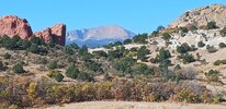
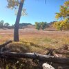
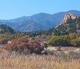
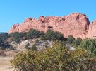
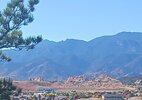
I went for a walk in Garden of the Gods Park this morning.
20231018_101627.jpg
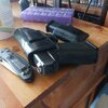
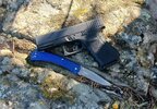
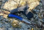
I carried my Glock and my Griptilian. It's a Glock, there are a million more just like it you know what they look like.
20231018_165437.jpg


A Downy Woodpecker at Rockledge Ranch.
20231018_090754.jpg
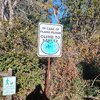
Ya think?
20231018_101225.jpg
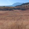
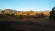
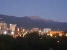
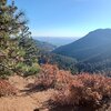
I love looking down this Valley.
20231018_093931.jpg
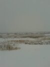
The South End
20231018_102152.jpg
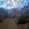
Looking South from GoG.


ETA I suppose I should have put in a picture of the actual formation that they call Garden of the Gods
20231018_100009.jpg
 
Last edited:
Ute Valley Park Colorado Springs.

20230816_095838.jpg
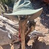
I've decided I'm really not comfortable unholstering in public for a gun selfie. So this is going to be my stock photo from now on. It's a Glock 19. It's always going to be a Glock 19. There are many like it but this one is mine.
20231020_124409.jpg
That is a stylish hat.
20231020_123031.jpg
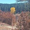
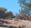
One Aspen surrounded by Scrub Oak and Ponderosa Pine.
20231020_115227.jpg
This is Wilson Creek Substation. I used to have to go do security checks on this place every other night. I do have to admit it was one of my favorite places to check because it was right in the middle of this park but I laugh every time I walk by it.
20231020_105827.jpg
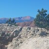
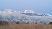
Pikes Peak from Rattlesnake Ridge (It's a stupid name but I'm not the one that named it).

20231020_110642.jpg
Looking Southwest towards Garden of the Gods.

 
I understand that you like your Glock 19!!!
I have one too (recent purchase) and I'm getting used to it!
I'm not sure "Like" is the right word. I mean it works. I don't rotate handguns I carry Glock 19 unless I can't conceal it and in that case I carry a Glock 26.
What load do you like for wilderness carry/self defense?
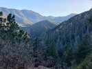
Speer Gold Dot 124 gr. +P.
Crackheads are Crackheads whether they're on South Academy Blvd or in Sweetwater Canyon

20221211_150955.jpg
 
@The Night Rider, I bet the substation area is different at night. That would be my longest stop for sure
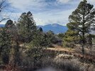
It depended on the night.

20220108_121235.jpg
I took this picture one morning sitting right outside of that substation after checking it. I was killing time waiting to go back to the office.

20231020_115056.jpg
I took this picture from the same place yesterday.

Like I said it depended on what the night was like. If I went out there in the middle of the night I checked it as fast as I could and got on to the next thing.

If I got there in the morning towards the end of my shift I tried to make it my last stop and I would get there around 7:00 a.m. or so and do my check and sit there for a half hour before driving back to the office. That's actually what I was doing when I took the first photo.

That assignment in general is one of the best assignments I ever had. There were places I could hide out all over the city.
IMG_20230327_202951_182.jpg
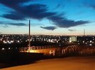
I took this picture Standing On Top of the city Administration Building at the corner of Nevada and Colorado Avenue in Colorado Springs. If I was on top of that building then I had the only keys to the only stairwell leading to the roof on my person. Great place to hide out.
FB_IMG_1634459269367.jpg
I took this picture on the corner of Circle and Venetucci in South Colorado Springs. right outside of a computer chip manufacturing facility called Microchip. Although when I took the picture I was working for the city and I was checking a substation 20210603_044731.jpg
I took this picture of the substation several years later when I actually worked at Microchip.
FB_IMG_1611214174978.jpg
I took this picture at the John Pinkerton Service Center. There was a substation on the property it was part of my duties to go check it every couple hours.
20210925_061836.jpg
I either took this picture on top of the municipal courthouse on Kiowa Street or I took it on top of the Kiowa parking garage.
20160320_064808.jpg
I took this picture on Mesa Road Colorado Springs on my way back to the office.

Screenshot_20231021_111040_Samsung Internet.jpg
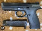
The gun I carried belonged to my employer and I turned it in when I quit working there. So this will have to do for a stand in. It's an M&P 40. FB_IMG_1487232374099.jpg

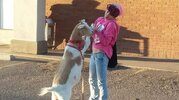
This may not be outdoors but it is most assuredly wildlife. I took this picture on 19th and Uintah Street on my way back to the office. It is a woman named Pink walking her Goat. ETA if I remember right the goat's name was Captain Morgan
 
Last edited:
20230816_095838.jpg
I did 16 and 1/2 Miles yesterday with a total elevation gain of I'm going to say a thousand feet. I drink 4L of water yesterday plus whatever I drank when I came home and I woke up this morning and I'm still feeling dehydrated.
20231022_092130.jpg
20231022_160703.jpg
20231023_090521.jpg
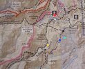
I don't know if posting this map is helpful. I know what I'm looking at because I know what I'm looking at but if you like just this little square lacks context except for you can see the kind of terrain I was on.

So I started at the Red Dot which is the gold Camp Road parking lot and I walked down to the Gold Dot and crossed Buffalo Creek.
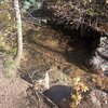
20231022_101753.jpg
This is Buffalo Creek but it's not where I cross. I walked up to that pool and I guess for context it's about 3 ft wide across the creek and probably 2 ft wide along the creek in about a foot deep. As you can see from where I took the picture my shadow is not on that water but I stepped on the path right next to the creek and there was a fish in it and as soon as my foot hit the ground it bailed. The only thing I can think is it felt the vibrations of my foot hitting the ground.
20231022_160703.jpg
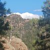
This is pretty close to the Blue Dot. That's Gold Camp Road. Is Mark gold Camp Trail on the map I don't know why because it is a road and it leads all the way out to Victor. It used to be the stagecoach route between Colorado Springs and the gold camps and Victor and Cripple Creek. For reference I was parked at the base of those mountains that are over the ridge. And I think at that point I had walked eight and a half miles.


Sweetwater Canyon Trail is not on that map but there is a trail and I was not bushwhacking. I thought about it when I came down over that ridge to Gold Camp Road but the trail was about a thousand feet down the hill from the road and I just knew that if I started bushwhacking down that Hill I was going to end up 500 ft Down Standing on the edge of a cliff and have to go all the way back up to the road.
20231022_150511.jpg
If you look on the map you'll see Mount Muscoco marked, that's it.


This is Buffalo Creek I actually had to climb over a little hump here to get back over into North Cheyenne Canyon. Almost every picture I show of a waterfall here is somewhere along this Creek

20231023_090315.jpg
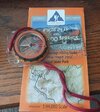
I try to plot my position on the map at least a couple of times a trip.
 
Last edited:
No wildflowers like @Mars5l posted in WI this time of year.
View attachment 1176974
I did 16 and 1/2 Miles yesterday with a total elevation gain of I'm going to say a thousand feet. I drink 4L of water yesterday plus whatever I drank when I came home and I woke up this morning and I'm still feeling dehydrated.
View attachment 1176975
Dude, you are making me tired thinking about the miles. Glad to hear you drank lots and lots of water!

Do carry what you will drink or filter water as you go?
 
It depends on where I'm at. I always have a filter on me and I have a three and a half liter bladder in my back. Whoever named Sweetwater Canyon was joking because there is no water in that Canyon. There's a seep at the bottom of the canyon.

I added more photos to my post
I try to carry more water than I think I will need! I have mentioned before that I have to add an emergency filter to my pack.
 
I try to carry more water than I think I will need! I have mentioned before that I have to add an emergency filter to my pack.

I bought one of these at Walmart for $25. Actually I think I bought two and I have one in each pack. I use them when I need to but I don't go out of my way to use them.


We bought one of these about a year ago for camping. We haven't used it yet but it has good reviews it's just a little much for a day hike.
 
....

View attachment 1175381
This is looking down North Cheyenne Canyon from the lower end of it.

Not far from there, 46+ years ago I got down on a knee and asked a lovely girl to be my wife. We've lived a blessed life ever since.

I've enjoyed your pictures of the area. We live in the Kansas City area now, but get back there to visit family every once in a while.
 
Back
Top